For public works, utilities and agencies
Your rasters, served in the protocols your GIS already speaks
Upload a GeoTIFF. giskit publishes it as an ArcGIS ImageServer, WMTS and XYZ tiles, WCS, an elevation API and download links, all at your own address.
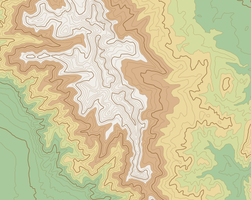
Legend
Five services on every dataset
ArcGIS ImageServer
Add by URL as an image layer, or as the ground surface of a 3D scene. Tiles are sent in LERC, the format ArcGIS expects for elevation.
/arcgis/rest/servicesArcGIS Online · ArcGIS ProWMTS and XYZ tiles
Your imagery, plus colour-ramp, hillshade and shaded-relief renderings of your elevation. Terrain-RGB tiles for 3D web maps.
/wmts · /tiles · /terrainQGIS · ArcGIS · MapLibre · LeafletWCS
Real pixel values, not pictures. Versions 1.0.0, 1.1 and 2.0.1, returned as GeoTIFF in the dataset's own coordinate system.
/wcsQGIS · ArcGIS Pro · GDALElevation API
Point heights, profiles, line of sight and cut/fill volumes, computed on request from your own surface.
/v1/elevationScripts · apps · web mapsDownloads
The whole dataset as a Cloud Optimized GeoTIFF that tools can read in place, or a GeoTIFF clipped to a bounding box.
/downloadGDAL · QGIS · contractorsFrom file to layer
- Step 1
Upload a GeoTIFF
Drag a single-band elevation raster or 3 to 4 band imagery into your browser. It uploads straight to storage.
- Step 2
giskit prepares it
We build a native-CRS copy for analysis and a Web Mercator copy for maps. You confirm the vertical datum and units before any height is served.
- Step 3
Share the address
Set each dataset to public or key-protected. Copy its address for ArcGIS, QGIS or GDAL from the dataset page and add it as a layer.
Paste one address
No plug-in and no new viewer. Each dataset answers at standard endpoints, so it opens in the software your staff and contractors already run.
Key-protected datasets take the key as an X-API-Key header, a ?key= parameter or basic auth.
- In Map Viewer choose Add, then Add layer from URL.
- Paste the ImageServer address and add it to the map.
- In Scene Viewer, add the same address as an elevation layer to use your surface as the ground.
https://yourcounty.giskit.io/arcgis/rest/services/lidar_2024_dem/ImageServer- On the Map tab choose Add Data, then Data From Path.
- Paste the ImageServer address and select Add.
- To browse every dataset you host, add a server connection to https://yourcounty.giskit.io/arcgis.
https://yourcounty.giskit.io/arcgis/rest/services/lidar_2024_dem/ImageServer- Choose Layer, Add Layer, Add WMS/WMTS Layer and create a connection.
- Paste the capabilities address and connect. Each dataset appears with its styles.
- For pixel values, add a WCS connection to https://yourcounty.giskit.io/wcs.
https://yourcounty.giskit.io/wmts/1.0.0/WMTSCapabilities.xml- Open the Cloud Optimized GeoTIFF over HTTP with /vsicurl/.
- GDAL requests only the byte ranges it needs, so clipping a project area does not download the county.
gdalinfo /vsicurl/https://yourcounty.giskit.io/download/lidar_2024_dem.tif

gdal_translate -projwin 494000 5084000 498000 5080000 \
/vsicurl/https://yourcounty.giskit.io/download/lidar_2024_dem.tif site.tif- Use the XYZ template as a raster source in MapLibre or a tile layer in Leaflet.
- For 3D terrain in MapLibre, point a raster-dem source at the Terrain-RGB tiles.
map.addSource("ground", {
  type: "raster-dem",
  tiles: ["https://yourcounty.giskit.io/terrain/lidar_2024_dem/{z}/{x}/{y}.png"],
  tileSize: 256,
});
map.setTerrain({ source: "ground" });Ask your terrain a question
The elevation API answers from the surface you uploaded, at its full resolution. The section on the right is the dashed line from A to A′ on the map at the top of this page: one profile request and one line-of-sight request.
- Point
- Height at a coordinate, or at thousands of them in one request.
- Profile
- Heights sampled along a line, as in the section drawn here.
- Line of sight
- Whether one point can see another, and what stands in the way.
- Cut/fill
- Volumes above and below a design grade inside a polygon.
For comparison, Esri's hosted elevation service answers from Esri's global data and costs $1 per 1,000 points after the first 50,000 each month (ArcGIS Location Platform pricing, November 2026).
Your data, your address
Your own address
Every organisation gets its own hostname, such as yourcounty.giskit.io. ArcGIS and QGIS projects save it, so it stays fixed once you publish.
Public or key, per dataset
Open a basemap to everyone and keep a design survey behind a key. Keys can be limited to named datasets and revoked at any time.
Stored in the United States
Rasters and account records are kept in US-jurisdiction storage on Cloudflare. There are no servers for your office to patch.
Usage you can see
Requests are counted per organisation and per service, so you know which layers are used and by how much.
Sheet notes
What giskit accepts and serves at launch, and what it does not do yet.
- Accepted files
- One GeoTIFF or Cloud Optimized GeoTIFF per dataset, up to 8 GB
- Elevation
- Single band, floating point or 16-bit integer
- Imagery
- 3 or 4 bands, 8-bit
- Horizontal CRS
- Any recognised system. Tiles are Web Mercator; WCS and downloads keep the native CRS
- Vertical datum
- Read from the file and confirmed by you. Unverified heights are never served
- Tiles
- 256 px, WebMercatorQuad. PNG colour ramps, hillshade, shaded relief and Terrain-RGB
- WCS
- 1.0.0, 1.1.x and 2.0.1 over GET and POST. GeoTIFF output
- Clipped downloads
- Up to 4,096 × 4,096 pixels per request
- Not yet
- Point clouds, vector layers, your own domain name, single sign-on, FedRAMP authorisation
Opens in
ArcGIS Online · ArcGIS Pro · QGIS · GDAL · MapLibre